
Tarrant County ZIP Code Coverage
Tarrant County has 41 incorporated areas, so county, city, and postal lines often diverge. The county ZIP map is helpful for comparing area labels, but its labels are not a promise that every address within a city uses that city name for mail. The selected examples below are deliberately narrow. They show the kinds of boundary, edge, special, and installation conditions that affect a postal-area search. They are not a countywide list of every service area.
| ZIP | Areas Covered | Post Office | Notes |
|---|---|---|---|
| 76013 | Arlington and Pantego | Not located in Tarrant County map; USPS verifies exact office | City and postal-area mismatch is possible. |
| 76015 | Arlington and Pantego | Not located in Tarrant County map; USPS verifies exact office | City and postal-area mismatch is possible. |
| 76092 | Southlake and Grapevine area | Not located in Tarrant County map; USPS verifies exact office | County map label is Southlake; verify the address. |
| 76108 | Fort Worth, Lakeside, and White Settlement | Not located in Tarrant County map; USPS verifies exact office | One postal area can cross several city limits. |
| 76118 | Fort Worth, North Richland Hills, and Richland Hills | Not located in Tarrant County map; USPS verifies exact office | Shared municipal coverage needs parcel-level confirmation. |
| 76127 | Naval Air Station JRB/Fort Worth | Not located in Tarrant County map; USPS verifies exact office | Installation or special ZIP; verify the exact address. |
| 76196 | Fort Worth county-government area | Not located in Tarrant County map; USPS verifies exact office | County-government or special-delivery label; verify. |
| 75050 | Grand Prairie | Not located in Tarrant County map; USPS verifies exact office | Tarrant and Dallas county edge area. |
| 75261 | Dallas and DFW airport edge | Not located in Tarrant County map; USPS verifies exact office | Airport or edge-service label; verify the exact address. |
The county data does not expose a named post office or station for each entry. The USPS address lookup is the authority for the exact delivery ZIP and should be used instead of inventing an office name from a map label.
Tarrant County ZIP Map Dates
The county’s 2026 ZIP Codes and Voting Precincts map is effective January 1, 2026. It also warns that map features can be revised without notice. That makes it a strong current context layer for a Tarrant County address, precinct, and nearby geography. It should not be treated as the final answer for a delivery route, because postal boundaries and delivery details are maintained separately.
The county ArcGIS service provides fields named NAME, STATE, SQMI, ZCTA, and POSTAL. Its metadata says the boundary source is December 2014. This creates a useful comparison: the 2026 county election map can describe current county context, while the ArcGIS polygon source has an older boundary reference date. USPS should settle the address-level delivery question.
The Tarrant County ZIP boundary service displays the field inventory and the December 2014 boundary-source note.
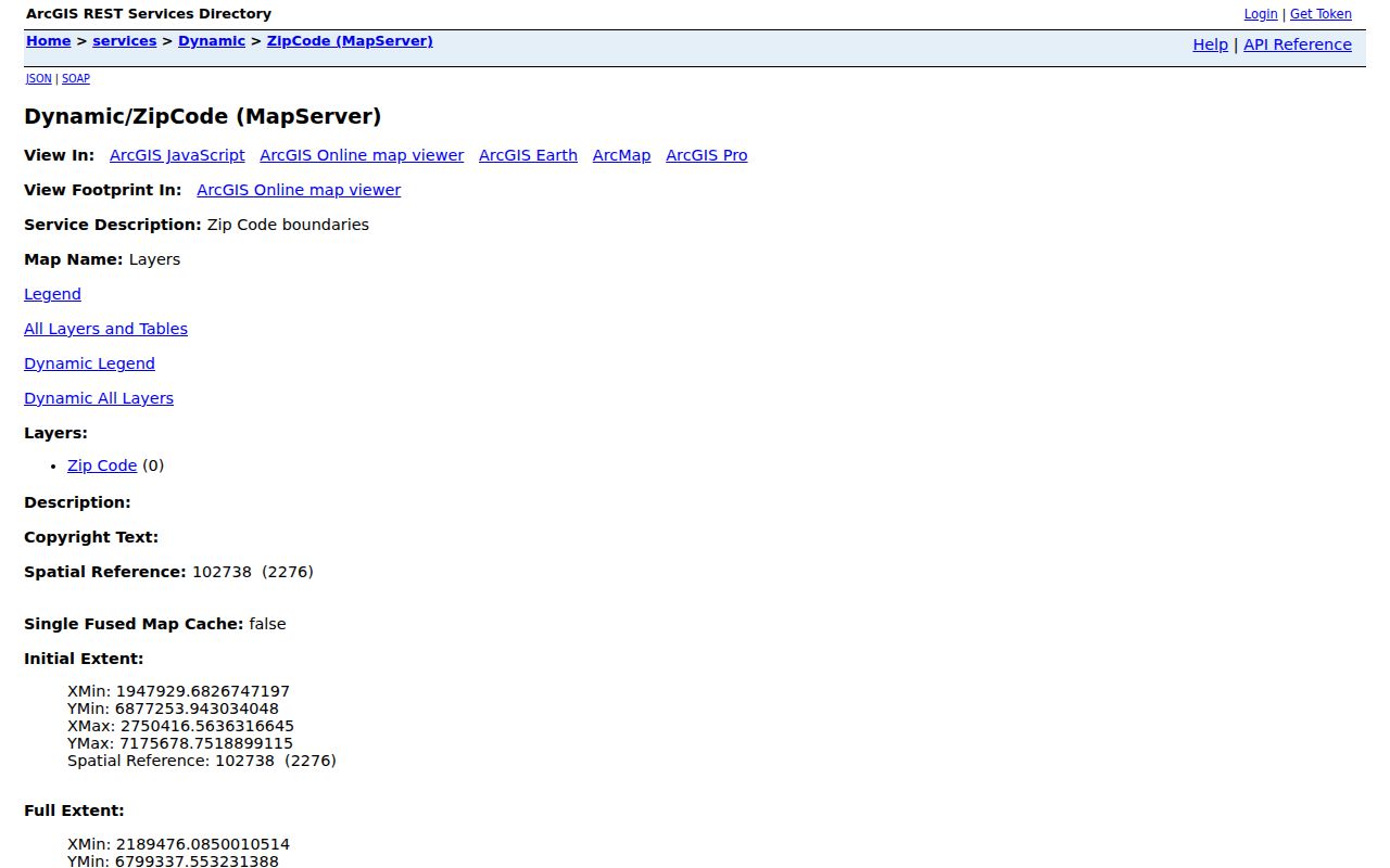
Use this service as a map reference alongside the current county map, then verify an individual delivery address through USPS. A polygon and a postal delivery result serve different purposes.
Note: The county’s effective-date map and the ArcGIS source date are both important because neither substitutes for USPS address verification.
Tarrant County ZIP Boundary Splits
The most practical postal-directory lesson in Tarrant County is that a label does not equal an incorporated place. Arlington and Pantego can share 76013 or 76015. Southlake and Grapevine can be part of the 76092 area. Fort Worth, Lakeside, and White Settlement can appear under 76108. The same pattern appears at 76118, where Fort Worth, North Richland Hills, and Richland Hills meet. A postal result needs the street address before it can be matched to the right local custodian.
TAD adds a separate parcel clue. Its legal descriptions can use “CITY BOUNDARY SPLIT,” showing that a tax parcel may sit across municipal context that a postal label cannot explain. CAID’s city-boundary layer is the right local comparison tool. For Fort Worth addresses, One Address can add permits and code material, but it is a Fort Worth-only municipal layer and does not establish a countywide resident record.
This is why a postal directory should be read as geography. It can narrow an address question and expose a boundary quirk. It cannot decide city jurisdiction, owner occupancy, school attendance, or a complete list of people within the postal area.
Find Tarrant County ZIP Records
No general public Tarrant portal produces a ZIP-wide resident roster. The useful method is address first, then parcel and jurisdiction context. TAD has Property City, Property Address, and Owner Address categories, but the inspected search screen did not expose a separate ZIP filter. CAID provides a ZIP layer while remaining primarily an address, owner-name, or tax-account map search. The voter interface uses an address or ZIP route for polling-place information, not a public all-residents query.
- Enter the full delivery address in the USPS service and keep the returned ZIP with the date of the check.
- Use the county ZIP and precinct map to see the postal-area context and whether a boundary or county edge is nearby.
- Open CAID with the address, turn on the ZIP and city-boundary layers, and identify the parcel rather than relying on a broad postal label.
- Use TAD Property Address or Property City to locate the tax parcel, then compare the situs address, owner mailing address, and legal description.
- Use the voter polling-place route only for its stated address or ZIP purpose. A county, precinct, or district voter-file request has separate forms and use limits.
Once the postal area has narrowed to a particular road, the Tarrant County street directory gives the address-by-address parcel and deed workflow. A ZIP alone is too broad for that task.
| Portal field or layer | Type | What it does | What it does not do |
|---|---|---|---|
| TAD Property City, Property Address, Owner Address | Search categories | Locates a current parcel using city or address information. | No separate ZIP filter was located on the inspected screen. |
| CAID ZIP layer | Map layer | Shows postal-area context around an address or selected parcel. | Does not guarantee USPS delivery details or create a person list. |
| TCVL address or ZIP route | Polling-place lookup | Finds the polling-place context for an address or ZIP. | Does not return all residents within that ZIP. |
| USPS address lookup | Address verification | Confirms the exact delivery ZIP for the submitted address. | Does not identify a parcel owner or municipal boundary. |
Tarrant County ZIP USPS Check
USPS resolves the delivery question at the level that county boundary maps cannot. Enter the complete address rather than guessing from a nearby business, neighborhood name, or municipal label. This is especially important for 75050 near the Tarrant-Dallas edge, 75261 near DFW, and special or installation labels such as 76127 and 76196. A map result may be a useful lead, but the address-level result is the one to preserve with a record search.
The official USPS lookup presents the address-to-ZIP verification route.
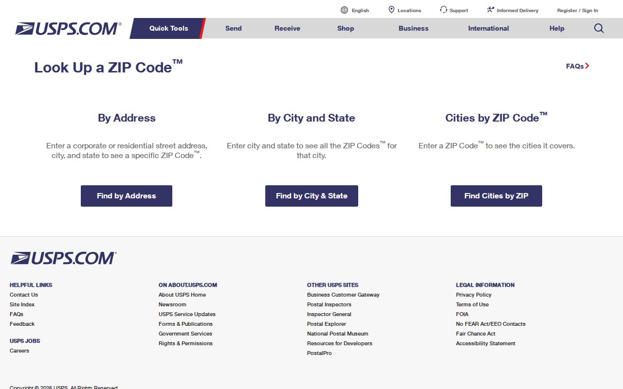
After USPS returns the delivery result, compare it with CAID and the city-boundary layer. That short comparison is often more useful than a broad postal-area search because it anchors every later record to one exact address.
Tarrant County ZIP Address Terms
Several address terms appear in a Tarrant County parcel search, and they do not mean the same thing. Keeping them apart avoids a false match when an owner lives elsewhere, a city label differs from the delivery label, or a deed identifies land by lot and block instead of street number.
- ZIP and ZIP+4
- The base ZIP identifies a delivery area. ZIP+4 adds a more precise delivery segment to the postal address.
- PO-box ZIP
- A postal label used for box or special delivery can differ from the one used by nearby street addresses.
- Unique ZIP
- A code associated with a single institution, installation, or specialized delivery arrangement needs address-level confirmation.
- Carrier route
- A postal delivery grouping. It is not a municipal boundary, parcel identifier, or resident roster.
- Situs and mailing address
- The situs is the property location. The mailing address is where the tax notice is sent and may be elsewhere.
- Legal description
- The deed’s land description, such as subdivision, block, lot, survey, or recorded reference, which can outlast a street-label change.
School attendance zones and utility districts are separate map layers. They should not be inferred from a delivery ZIP, even when the postal city and municipal city happen to match.
Tarrant County ZIPs in Old Directories
Historical directories generally use city and street conventions, not modern postal codes. A researcher working with an old Fort Worth, Arlington, or North Fort Worth address should search the printed city and street form first. The 1912 Fort Worth map and 1919 North Fort Worth map preserve earlier street, rail, river, and city-limit context. They are useful for testing whether a present-day postal area fits an old address, but they do not supply a historic ZIP conversion.
No official countywide street-renumbering year was located. Compare the directory entry, its date, the historical map, and the legal description when available. The North Fort Worth Street Occupancy material for 1909 to 1910 and the 1975 Wallace Street Guide are address-oriented examples, but real year gaps remain. A current delivery ZIP should never be retrofitted onto a historical listing as if it had appeared there.
Note: Historic city and street evidence can identify an earlier address context, while USPS resolves a current delivery address.
Tarrant County ZIP Code City Limits
Postal boundaries and city limits answer different questions. A mailing city can be a postal label rather than an incorporated place, and an unincorporated pocket can share the nearest postal city. In Tarrant County, the county map, CAID city-boundary layer, tax parcel, and USPS result should be read together. This is the safe comparison for property history, civic questions, or an address that appears in more than one municipal context.
For a current Tarrant County parcel, TAD supplies the situs and owner mailing fields, while the legal description supplies the deed land reference. Tarrant County CAID supplies boundary context. USPS supplies delivery geography. The county voter tool can provide polling-place information through its address or ZIP route, but it does not turn postal geography into a public resident list. Treat each result as a record from its own custodian and verify the final fact with that office.
Boundary check. When a Tarrant County address sits near a city or county edge, save both the USPS delivery result and the county map context before requesting any record.